Since there were reports of the observations of the bright object at very distant places, it is possible to compute the path of the object in space.
I used the following dataset:
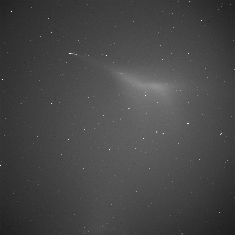
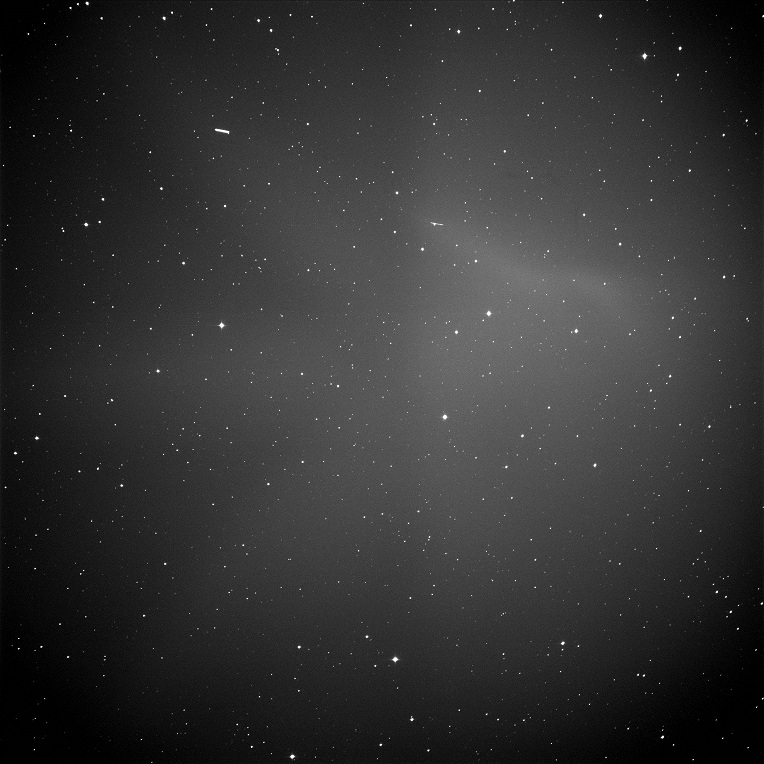
- images taken at Observatorio Astronomico Los Molinos (Montevideo, Uruguay) by S. Roland and N. Martinez with the telescope Centurion 18" f/2.8 + CCD FLI ProLine PL09000
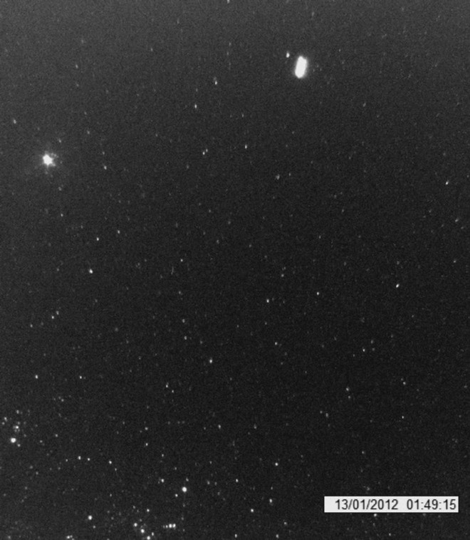
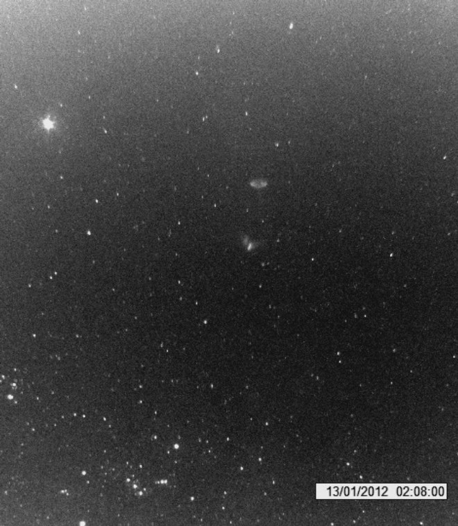
- all sky video taken at the Space Observatory (San Pedro de Atacama, Chile) by A. Maury
Two images are selected from each set. The coordinates of the object are computed by Astrometrica in the OALM CCD images, and by visual comparison with a Star Chart in the video snapshots.
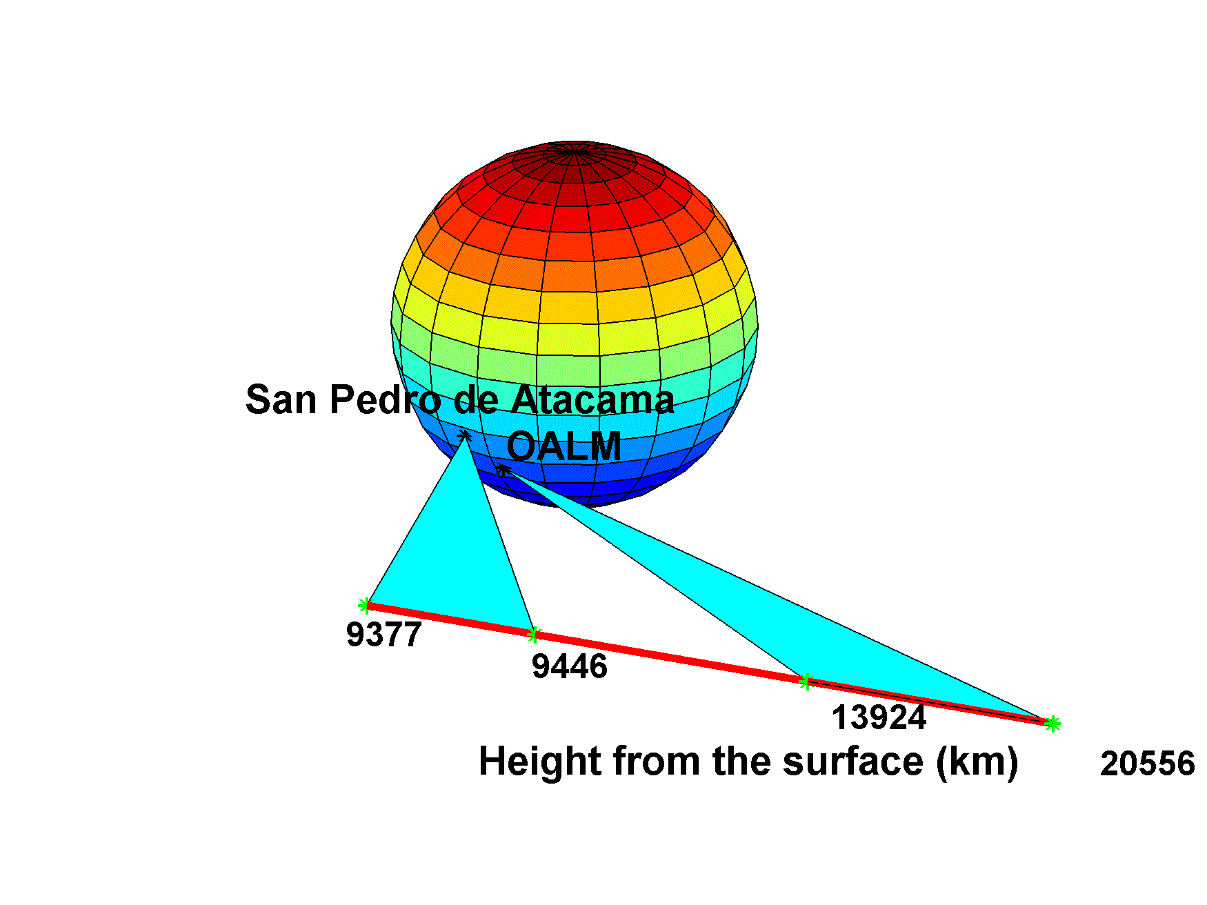
OALM
San Pedro de Atacama
Assuming a straight path, we can compute the path as the intersection between the two planes defined by the position of each observer and the two directions.
In the figure and the movie, we present the solution. The values in the figure are the height of the object above the surface at different times. According to this solution, the object rises from ~9000 km above the surface to ~20000 km at the last image.
Download animation with different views of the path in space
This solution is compatible with trajectory of the upper stage of the chinese rocket Long March 3A, which launch the Geostationary satellite Fengyun 2F.
Therefore, I think the problem is closed.
Dado que hay reportes de las observaciones del objeto brillante desde lugares distantes, es posible calcular la trayectoria del objeto en el espacio.
Se usaron los siguientes datos:
- imagenes tomadas desde el Observatorio Astronomico Los Molinos (Montevideo, Uruguay) por S. Roland y N. Martinez con el telescopio Centurion 18" f/2.8 + CCD FLI ProLine PL09000
- video de camara all sky tomado en Space Observatory (San Pedro de Atacama, Chile) por A. Maury
Dos imagenes son seleccionadas de cada grupo de imagenes. Las coordenadas del objeto son calculadas con Astrometrica para el caso de las imagenes del OALM, y mediante comparacion visual con una Carta Estelar en el caso de las imagenes extraidas del video.
OALM
San Pedro de Atacama
Asumiendo una trayectoria lineal, podemos calcular la trayectoria como la interseccion entre los dos planos definidos por la posicion de cada observador y las dos direcciones.
En la figura y en la animacion, se presenta la solucion. Los valores que se presentan en la figura son las alturas del objeto respecto de la superficie a diferentes tiempos. Segun esta solucion, el objeto sube desde los ~9000 km sobre la superficie hasta los ~20000 km en la ultima imagen.
Bajar animacion con diferentes vistas de la trayectoria en el espacio
La solucion es compatible con la trayectoria de la etapa superior del cohete chino Long March 3A, que transportaba el satelite geostacionario Fengyun 2F.
Por lo tanto considero que el problema esta resuelto.